
You’re welcome to search out the guide books when planning a trip but the best and simplest source of information I found is a brochure called, ‘Henry’s Fork of the Snake River, River Guide and Access Map.’ The brochure is available at no charge and is published by The Henry’s Fork Foundation. Their office is on Main Street in downtown Ashton or they can reached through their web site at www.henrysfork.org. Negotiating the Henry’s Fork and the surrounding community is relatively simple. As you are approaching the area from the north you will be coming in on highway 20. It’s a north-south highway running the full length of the river as far south as St. Anthony, which is considered the southern most part of the upper river.
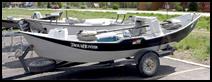
McKenzie River Boats are common
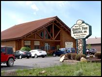
Anglers,’ an excellent place to stop and buy your souvenir t-shirt, get some local fly patterns and some excellent river advice. Restaurants, bars, motels and lodges are plentiful along the highway. Good lodging may require some research. Many of the adequate to really good places are located off of the main road. During peak fishing season, accommodations may not be available, so reservations would be in order for this trip.
I don’t impress easily when it comes to food. Most every place I ate was adequate, with one exception, if you’re in the Ashton area stop by and try the ‘Trails End Restaurant.’ Their prices are great and their portions are huge. Their country fried steak was truly a memorable experience.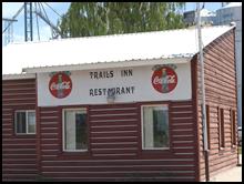
See you on the water…..
Tom Deschaine
~ www.michigandryflies.net ~
Copyright2013©Deschaine
Originally published Oct 21, 2013 on Fly Anglers Online by Tom Deschaine.