|
Limnologists use a wide variety of measurements
to describe a lake. Few of these are important
to anglers. One that clearly is, is a depth
profile, or in the lingo, a bathymetric map.
Vast numbers of lakes have been mapped and the
maps are usually availabe from government sources.
Fishing a lake (as opposed to a pond) without
a bathymetric map is handicapping yourself. The
rapid expansion of computer products includes
three-dimensional bathymetric maps. Figure 2a
is a standard map and Figure 2b an example of a
3-D map. Both were supplied courtesy of
Underwater Technologies Inc.. Information on
how to obtain the 2-D and 3-D maps (in colour)
of many North American lakes can be found at
www.utmaps.com.
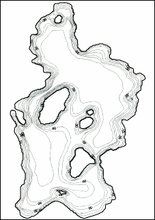
Figure 2a: Bathymetric map of Lake Anywhere, a typical
glacial lake that would support salmonids.
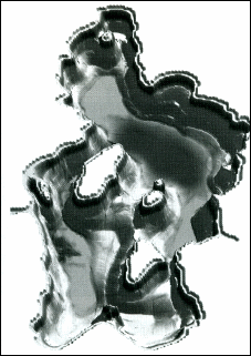
Figure 2b: A 3-D map of Lake Anywhere. ~ PCM
More next time.
Credits: Excerpt from Stillwater Fly Fishing,
Tools & Tactics By Paul C. Marriner, published
by Gale's End Press. We appreciate use
permission.
|

