"In the night I dreamed of trout-fishing;
and, when at length I awoke,
it seemed a fable that this painted fish
swam there so close to my couch..."
Henry David Thoreau penned those words about a trip he made
to northern Maine's Allagash River region in 1846.
A century and a half later, wild brook trout can still be
found in the waters outside the tent flaps of adventurous
fly fishers who travel to the Allagash.
The Allagash Wilderness Waterway, as it was officially named
in 1966 when the state of Maine set it aside for protection,
encompasses a chain of big headwaters lakes and the powerful
river they feed. The 100-mile long watercourse, which is also
a National Wild and Scenic River, sprawls across the rural
north-central part of the state.

Along with native brookies and lake trout, the Allagash
contains brawling rapids, brooding lakes, ancient portages,
remnant stands of old-growth white pine forest, moose, bear,
loons and blackflies. Fear of the latter swarming pests keeps
some people from venturing into the area in spring, when stream
fishing is good. But heavy doses of repellent and cigars can
hold black flies at bay in late May and June, when they are
most severe.
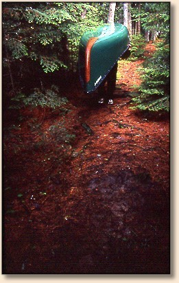
A multi-day float/fly fishing trip is one of the best ways
to experience the Allagash. Day trips are possible, but
there are only a few sporting lodges in the area and the
nearest town to the south, Millinocket, is about 50 miles
of rough logging roads away. There are no towns or services
along the river, largely because much of northern Maine
remains owned by timber companies, so commercial forests
lie beyond the public waterway's boundaries.
Keep in mind that lack of services along the river means
paddlers must bring all food and gear with them. There's
nowhere to re-stock ice chests or fly boxes, so people who
venture onto the river have to be prepared for a self-contained
trip.
Of course, there are plenty of guide services in the region
that will supply all the food and gear for an Allagash
excursion. During a guided trip, anglers are usually
responsible to bring their own rods and reels, tackle,
sleeping bags and personal amenities; everything else is
generally provided.

Visitors who camp along the waterway must use designated
campsites, which are often spaced more than a mile apart
to allow for privacy and maintain the peaceful character
of the Allagash. The sites haven't changed much since
Thoreau journeyed into the area: there's a table and tarp
pole at each site, along with a fire ring and nearby outhouse.
Many sites have springs near them, but the waterway cautions
people to purify any water you plan to drink.
The state of Maine still manages the Allagash as a wild
fishery and no stocking takes place.

Several canoe trips of varying mileage are possible on
the Allagash. The longest is about 110 miles, beginning
at 4,300-acre Allagash Lake, at the very top of the
watershed, descending the headwaters lakes and into the
river, then ending at Allagash Village, just above the
confluence with the St. John River. A slightly shorter
trip of some 90 miles starts at Chamberlain Lake and
ends at tiny Allagash Village.
An even shorter trip of about 60 miles, which skips the
headwaters lakes, starts at Churchill Dam and ends at
Allagash Village.
For those who have a week to spend on the river, the
Allagash Lake put-in is attractive because good fly
fishing for brookies is possible during key hatch
periods.
"The best time to fly fish Allagash Lake in my opinion
is from mid-June to about July 7. This is when we get
our big green drake hatches and the lake can come alive
if you hit it right," says Mike Yencha, who runs Loon
Lodge, a sporting camp several miles from the lake.
"Even the larger trout will come to the surface" during
the major green drake hatches. "And by large, I mean
trout up to 4 pounds."
Yencha suggests a size 6 or 8 green drake pattern. Yellow
Hornbergs in similar sizes also work well when the bite
is on.
Special regulations allow only non-motorized canoes on
Allagash Lake and prohibit vehicles from driving within
one mile of the shore. These kinds of restrictions
generally mean people who put the effort into getting
to the lake can find solitude and decent fishing.
After mid-summer temperatures cool off, the fishing picks
up again in September with caddis hatches in both Allagash
Lake and its inlet and outlet streams. A size 12 or 14 elk
hair caddis pattern works well for autumn fishing, Yencha
says.
From Allagash Lake, the waterway continues down Allagash
Stream, a thundering little river navigable by canoe
throughout the spring and early summer in most years.
Canoeists who tackle Allagash Stream should feel
comfortable paddling in Class II whitewater, as there
are some sharp ledge drops and rapids on the stream.
There is one scenic portage around impassable Little
Allagash Falls.
After about 6 miles, Allagash Stream flows into
Chamberlain Lake, a 15-mile-long, narrow body of water
that can get rough in high winds. To avoid the winds,
paddlers can use a three-quarter mile portage trail at
the northeast cove of Chamberlain Lake, taking it to
Eagle Lake. The path passes next to a pair of old
locomotives, relics from the region's lumbering days
100 years ago. Or canoeists can continue down the east
shore of Chamberlain Lake and float down a mile-long
canal to get to Eagle Lake.

Chamberlain and Eagle lakes hold brook trout and togue.
Brookies are easiest to find in the spring, when fly fishers
often troll streamers such as grey ghosts or big smelt patterns
along the shoreline. Hatches of caddis and drakes also bring
brookies to the top in early summer.
After crossing Eagle Lake, then Churchill Lake, the next
major waypoint is Churchill Dam, which impounds the Allagash
headwaters lakes. The actual river portion of the waterway
begins below the dam. The swift current below the dam draws
brook trout from downstream, and fishing the pools with hare's
ear and caddis nymphs can be good.

A nine-mile pitch of water called Chase Rapids begins at
the tailrace of the dam. Canoeists not comfortable with
navigating Class II rapids can pay a ranger $10 for a
shuttle to the bottom of the whitewater section. Or they
can just have their gear shuttled downstream and run the
rapids in empty canoes. The pools between the fast water
sections can hold big trout, so it might be wise to bring
a fly rod that can be stowed in the boat when paddling
through the whitewater.
After the rapids, the river flows into Umsaskis Lake, then
Long Lake, about 15 miles total. Trolling big streamers en
route often elicits strikes. The bluff overlooking washed-out
Long Lake Dam offers nice campsites and the deep pool below
the dam can give up nice fish on nymphs and streamers. A
sink-tip line will help get streamers down to the fish in
the slick current.

Below Long Lake Dam the river cruises for 10 miles to Round
Pond, the last lake on the waterway. From Round Pond, the
river flows some 18 miles to Allagash Falls. The river
between the pond and falls contains some productive
stretches, with quickwater, riffles and deep pools ballasted
by cobblestones and car-sized boulders. As the main river
warms in June, fly fishers can usually find brook trout at
the mouths of the many feeder streams that pump cold water
into the Allagash. Attractor dries such as a #12 Royal
Coachman or Humpys often work well here, along with streamers
such as Woolly Buggers and Muddlers.
Allagash Falls, near the end of the waterway, provides
a scenic highlight to the trip. The falls thunder down
a 40-foot cascade and roar into a big pool where nymphing
can net good brook trout fishing.

The river continues for another 14 miles or so downstream
of Allagash Falls, ending at the confluence with the St.
John River, in the tiny town of Allagash.
For more information about Allagash Lake and the Allagash
Wilderness Waterway contact:
Northern Region, Bureau of Parks and Lands
106 Hogan Road
Bangor, ME 04401
(207) 941-4014
Anglers may purchase licenses online and get information
on fishing regulations via the Maine Department of
Fisheries and Wildlife at: https://www.informe.org/moses/
For maps and rules about access to the region via paper
company roads:
North Maine Woods, Inc.
P.O. Box 421
Ashland, ME 04732
A Delorme Gazeteer for Maine will also prove invaluable;
find one at most sporting goods stores.
For guide service, lodging, shuttle arrangements and
floatplane access in the region, contact:
Loon Lodge
(May 1 to Nov. 30th)
P.O. Box 404
Millinocket, ME 04462
(207) 745-8168
(Dec. 1 to April 30)
P.O. Box 2469
Wilkes-Barre, PA 18703
(570) 287-6915
www.loonloddge.com
Allagash Guide Service
RR1 Box 131D
Allagash, ME 04774
(207) 398-3418
allaguide@ainop.com ~ Rob
About Rob:
Rob currently works for the Associated Press as News Editor for the Press
Multimedia Services in NYC. Responsible for rewriting and posting
breaking news, business and sports stories for AP online customers
including Yahoo! news, ABC.com, and hundreds of Web sites operated
by daily newspapers throughout the country. He has a wide background
as a editor and writer, including a stint as Photojournalist for
Pacific Stars and Stripes. We are delighted to welcome his voice here.
You can reach Rob at robjag@optonline.net
|