
I carry a thermometer and use it quite often. Most often I use it when I am NOT catching fish to see if the temps are too high. Unfortunately, I don't use log books. Too lazy I guess.
I think on of the best tools of a fly fisher is observation. By that I don't mean observing for feeding fish or hatches, but other things that most fly fishers miss.
I look for boggy areas along the banks in the spring of the year. Look for running water or seeps from springs. I also look for inlets from hidden springs. These are located along the edges of the stream and they will look like silty areas. Take a temperature reading and it will be cooler than the main stream. During July and August, the fish will be located downstream on that side of the river. There is one such spring in a river I fish and the water temperatures are 5 degrees cooler on that side of the river. I always catch fish there when the rest of the river seems dead.
During the summer on one of my favorite streams, the fish migrate as the weather gets hotter. There is one place where the fish are always found at the bottom on the left side of the river in an area about the size of a bathtub. There must be a spring that comes in at the bottom of that area of the river. There is nothing on the bank that indicates a spring in that location, but the trout are always there.
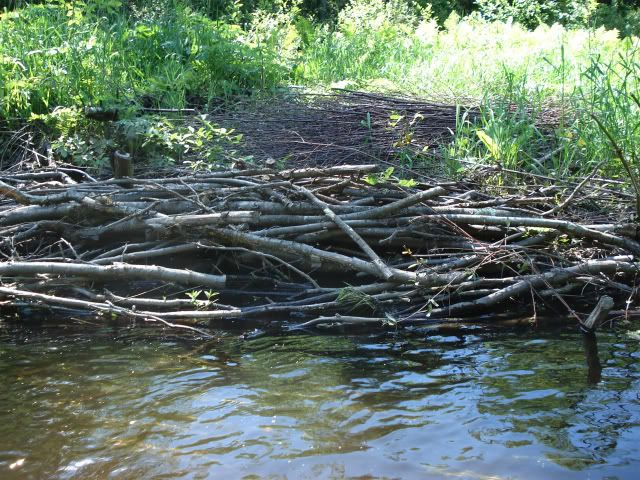
I learned this method of locating fish when I went out with a DNR specialist to map out a river for stream improvement. We planned to narrow and deepen the channel. One side of the bank is left as is and that side of the river is deepened by digging out the bottom. The river is narrowed by piling the material up in the river to form an artificial berm for the opposite bank. When that is done, the opposite side of the river will be cut off from the main channel. We pile old Christmas trees and brush bundles between the new berm and the old bank to silt in that side of the river. If we didn't locate the springs, we would be cutting off cold cold water flows from the new river channel
We put out stakes every 10 yards, and he noted which bank of river would be preserved. When he located spring flows, he made sure that that side of the river was kept intact and the opposite side was the one that was cut off. So in the improved areas, the natural springs will always be on the side of the natural bank and not on the man made side.
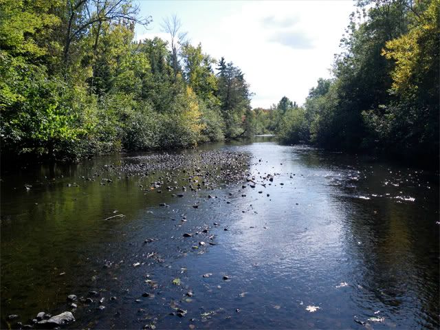
The photo below is of an area of a river in its natural state without narrowing and deepening. It is just upriver of where the improved section begins. You can see that the stream is 20 yards wild and 6 inches deep. Very poor habitat for trout and the water heats up faster when it is shallow and exposed.
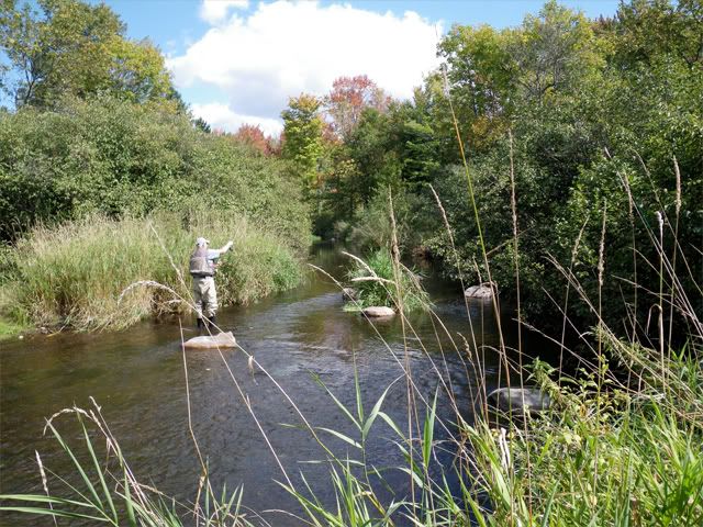
Here is a improved section about 50 yards downstream on that same rive. Note that the river has been narrowed by 2/3, boulders placed, adn natural cover planted on the new bank on the left side. Notice the old bank with the larger trees behind the new bank on the left. Any springs will be found on the right side with the original river bank.
Here are brush bundles in the river.
Regards,
Silver
"Discovery consists of seeing what everybody has seen and thinking what nobody has thought"..........Szent-Gyorgy


 Reply With Quote